Commute From Alexandria to DC: Times, Metro and Schools
Every commute figure here was measured from 766 N Howard Street on 5 October 2026 and labelled walk or drive: 13.9 minutes to downtown DC off-peak, 11.1 to the Pentagon, 8.3 to Van Dorn Street Metro, which is Blue Line only. Plus why we will not print a school assignment for an Alexandria address.
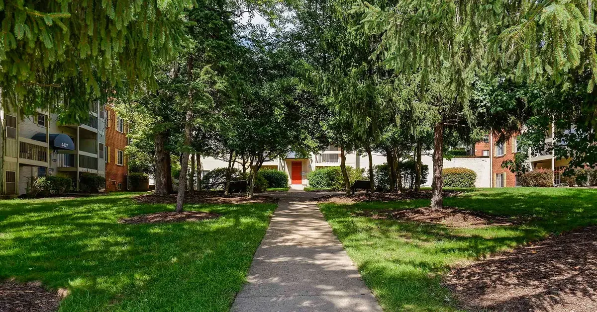
If you are weighing an Alexandria address against a job in the District, the honest answer is that almost nobody's commute from here is the number on the listing. Marketing pages round, they quote the best hour of the day, and they rarely say whether they mean walking or driving. So every figure below was measured from one address, 766 N Howard Street in Alexandria's West End, on 5 October 2026, using open routing engines, and every one is labelled walk or drive. Where a figure is free-flow rather than rush hour, it says so. Where we could not verify something, we say that too, which is why there is no school assignment and no parking rate here.
How long the drive from Foxchase to DC actually takes
Downtown Washington is 8.41 miles from 766 N Howard Street, and the off-peak drive to Metro Center is 13.9 minutes. That is the free-flow figure from the OpenStreetMap routing engine on 5 October 2026, and it is the number you will experience on a Sunday morning, not on a Tuesday at eight. Treat it as the floor rather than the expectation.
What makes that floor low is geometry. The West End sits just inside the Capital Beltway with I-395 running north-east toward the Fourteenth Street Bridge, so the route into the District is close to a straight line with no river crossing until the very end. That is structurally different from a Maryland or outer Fairfax commute, where the distance is longer and the bridge or the Beltway is in the middle of the trip rather than at the end of it.
The two Metro stations, and how long it really takes to reach them
Two Metrorail stations sit within nine minutes of the property by car. Van Dorn Street is 2.89 miles and 8.3 minutes. King Street-Old Town is 3.27 miles and 8.9 minutes. Both figures are drive times, off-peak, measured on 5 October 2026.
Neither is a walk, and this is the single most common misreading of an address like this one. Routed on the pedestrian network rather than the road network, Van Dorn Street Metro is 2.78 miles and 59.7 minutes on foot. That is a verified walking figure at 4.5 kilometres per hour, which is a real human pace. If you see a page describing a station two and a half miles away as a short walk, the person who wrote it almost certainly asked a car routing engine for a walking time and published what it handed back.
There is a third station worth knowing about. Eisenhower Avenue is 3.33 miles and 9.8 minutes by car, barely a minute further than King Street, and it matters because of which line stops there rather than how far away it is.
Rent bands, floor plans and what a unit here actually costs are a separate question from how you get to work, and they are covered properly in our honest assessment of whether Foxchase is worth it.
Van Dorn Street is Blue Line only, and listings still get this wrong
Van Dorn Street is served by the Blue Line and nothing else. Yellow Line service through Van Dorn Street, the Rush Plus pattern that ran to Franconia-Springfield, ended in June 2017. It has been gone for more than nine years and listing descriptions still say Blue and Yellow.
This is not pedantry, because the two lines go to materially different places north of the Potomac. The Blue Line runs through Arlington Cemetery and Rosslyn before turning east into the District, which puts Foggy Bottom, Farragut West, McPherson Square and Metro Center on your one-seat ride. The Yellow Line crosses the river directly into L'Enfant Plaza and continues up Seventh Street through Gallery Place toward Shaw and Columbia Heights. If your office is near L'Enfant Plaza, a Blue Line station is not the station you want, and you will discover that on your first Monday rather than on the listing.
King Street-Old Town carries both the Blue and the Yellow Line, which is what makes a nine-minute drive to it worth more than the extra half mile suggests. Eisenhower Avenue is Yellow only. So from this address you have off-peak access to a Blue-only platform in 8.3 minutes, a Blue-and-Yellow platform in 8.9, and a Yellow-only platform in 9.8. Which of those three is the right one depends entirely on where you work, and it is worth deciding before you sign anything.
Driving to the Pentagon, Crystal City and National Landing
The Pentagon is 5.72 miles and 11.1 minutes off-peak, measured to the Metro station entrance rather than to the middle of the building. Crystal City, the core of what is now marketed as National Landing, is 6.15 miles and 12.5 minutes, measured to the Crystal City Metro station.
Those two numbers carry most of the weight of this location. Defence and contracting employment in Arlington is the single largest reason people look at the Alexandria West End in the first place, and an eleven-minute free-flow drive to the Pentagon is genuinely unusual for an address this far from the river. It is also the reason the rail question above matters so much, because the Pentagon sits on the Blue and Yellow lines both, and Van Dorn Street gives you only one of them.
Closer in, Mark Center is 1.61 miles and 5.7 minutes, routed to 4800 Mark Center Drive, so a Mark Center job is a single-digit-minute commute from here. Inova Alexandria Hospital is 0.61 miles and 2.8 minutes, which is worth knowing whether you work there or merely want to know where the emergency room is.
Reagan National, Fort Belvoir and Tysons, measured the same way
Reagan National Airport is 6.15 miles and 13.9 minutes by car to the terminal frontage, short enough that an early flight does not require a hotel the night before.
Fort Belvoir is 13.38 miles and 23.0 minutes, routed to Tulley Gate rather than to the centre of the installation, because routing to the middle of a military post produces a number that corresponds to no journey anyone has ever made. If you are posted to a different gate, your figure will differ, and the sensible move is to route to your actual gate rather than to the word Belvoir.
Tysons is the outlier. Tysons Corner Center is 10.78 miles and 25.3 minutes, which is less distance than Fort Belvoir and more time, because the route runs up I-395 and across the Beltway rather than down a highway. It is the clearest illustration here that mileage and minutes are not the same quantity.
If you are comparing compact units across this part of the city as part of that calculation, our guide to efficiency apartments in Alexandria covers what the small-unit inventory here actually looks like.
Buses from the property, and what the walk to a stop really is
The nearest bus stop is a 253-metre walk from the property, which the pedestrian routing engine puts at 3.4 minutes. That is a verified foot figure at 4.5 kilometres per hour, not a straight line and not a car engine's answer to a walking question.
Checked against OpenStreetMap on 5 October 2026, eight bus-stop nodes sit within 400 metres of 766 N Howard Street, on North Howard Street and North Jordan Street, all tagged to WMATA Metrobus. The route relation that resolves from those stops is the F20 Leesburg Pike line, which runs south from Tysons and terminates at King Street-Old Town. Route-relation data in OpenStreetMap is incomplete, so that is the only route number worth asserting, and it is not the only service on those poles. The City of Alexandria's DASH network also operates across the West End, and the sensible thing is to pull up the current timetable from the operator rather than trust a route number printed in any article, including this one.
What can be said with attribution is that residents name the bus explicitly. The community's own published review set, reported in our earlier piece on what renters should know, has residents citing direct bus service to Metro as a reason the location works without a car. That is the community's claim about its own residents rather than an independent audit, and it is worth weighing as exactly that.
Parking at the stations, and the time the park-and-ride really costs
We are not publishing a parking rate, and the reason is the same reason this article exists. Metrorail parking charges change, availability at a given lot changes, and a figure printed today is a figure that misleads someone in March. Check the current rate and capacity with WMATA for the specific station you intend to use before you build it into a budget.
What is worth modelling is the time, because that is where the park-and-ride pattern quietly costs you. The 8.3-minute drive to Van Dorn Street is the drive alone. A realistic door-to-platform figure adds the walk from your parking space, the wait for a train, and on a bad morning the loop around a full lot looking for a space. The same addition applies at King Street-Old Town, which sits in a far denser part of the city where on-street parking is governed by residential permit rules.
What peak hour does to every number above
Every drive figure in this article is free-flow. That is deliberate, because a free-flow number is reproducible and a rush-hour number is not, but it means none of them is your Tuesday morning.
The corridor that governs this address is I-395 north-east toward the Fourteenth Street Bridge, and it is reliably congested in the peak direction on weekday mornings and in the reverse peak in the evening. The commuters who post about this route most often describe a morning drive into the District in the twenty-five to thirty-five minute range on a typical day, against the 13.9-minute free-flow figure, and that gap is the honest shape of the thing. Rail is less variable than the road at the same hour, which is the main argument for driving to a station rather than into the District.
Two practical consequences follow. The first is that the ranking of your options can invert at peak, because a drive that is fastest at ten in the morning may not be fastest at eight. The second is that the only number that matters is yours. Drive your actual route, at the actual hour, on an actual weekday, before you sign a lease. Everything above is a floor and a method for comparing addresses, not a promise about your Tuesday.
Townhome layouts and the stairs question are a different part of the decision, and our guide to townhomes for rent in Alexandria handles it.
Schools: how Alexandria assigns them, and why listing-site data is unreliable
This address is in the City of Alexandria, so it is served by Alexandria City Public Schools, not by Fairfax County. That matters, because the two are separate divisions with separate boundaries and the West End sits close enough to the county line that people assume otherwise.
We are not going to tell you which schools serve 766 N Howard Street, and that refusal is the most useful thing in this section. ACPS assigns schools by the street address of the parent or guardian, and the division is in the middle of a redistricting. At its meeting on 12 June 2025 the Alexandria City School Board approved Elementary School Triangle Map Plan 3 and Middle School Option E as the final boundary changes for the 2026-27 school year. ACPS states that approximately 1,400 currently enrolled students are affected and that the new boundaries took effect on 1 July 2026. The division's own locator still asks families to toggle between the 2025-26 and the 2026-27 result, and the schools page carries a standing warning that current boundaries may be subject to change because of the recent redistricting process.
Put plainly, any school assignment printed for an Alexandria address right now is a snapshot of a moving target, and a listing site's school module is a cached snapshot of a moving target. Those modules are rebuilt on a vendor's schedule rather than the school board's, they rarely distinguish the school year they describe, and they attach a rating that was calculated for a catchment that may no longer exist. A competitor will print a zone and a number because it fills space. We will not, because the number would be wrong often enough to matter to somebody choosing a home for a child.
Here is what to do instead. Enter the exact street address into the official ACPS Attendance Zone Locator, which returns the assigned elementary, middle and high school and also determines school bus transportation eligibility, and toggle between the school years so you can see both the current and the incoming result. Then telephone the registrar at the school the locator returns and confirm it before you sign anything, because the registrar holds the authoritative list and the website does not. Do this per address, not per community, because a boundary can run between two buildings.
It is worth knowing the shape of the division while you do it. ACPS operates one comprehensive high school, Alexandria City High School, split across the King Street Campus for grades ten to twelve, the Minnie Howard Campus for grade nine, and a satellite campus. Below that sit two middle schools, Francis C. Hammond and George Washington, two K-8 schools, Jefferson-Houston and Patrick Henry, and a set of elementary and pre-kindergarten schools. A single comprehensive high school means the high school question resolves the same way for almost everyone in the city, while the elementary and middle questions are precisely the ones the redistricting moved.
Drive and walk times were measured on 5 October 2026 from 766 N Howard Street using open routing engines, with walking routed on a pedestrian profile and verified at 4.5 kilometres per hour. Drive figures are free-flow and will be longer at peak. Floor plans and square footage come from the community's live property feed, checked 5 October 2026. The published recurring fee schedule lists no additional recurring fees, checked 2026-09-10; utilities are billed by usage and deposits are handled separately from rent. Availability and pricing move, so confirm anything that matters with the leasing office before you decide.
Frequently asked questions
How long is the commute from Alexandria to DC?
From 766 N Howard Street in Alexandria's West End, downtown Washington is 8.41 miles and a 13.9-minute drive off-peak, measured to Metro Center on 5 October 2026. That is a free-flow figure. Drivers on this corridor commonly describe twenty-five to thirty-five minutes into the District on a typical weekday morning, so treat 13.9 minutes as the floor rather than the expectation.
Is Van Dorn Street Metro on the Blue Line or the Yellow Line?
Blue Line only. Yellow Line service through Van Dorn Street, the Rush Plus pattern running to Franconia-Springfield, ended in June 2017, and listing descriptions still get this wrong nine years later. For a Yellow Line platform you want King Street-Old Town, which carries both lines, or Eisenhower Avenue, which is Yellow only.
Can you walk to Van Dorn Street Metro from the Alexandria West End?
Not realistically from this address. Routed on the pedestrian network rather than the road network, Van Dorn Street Metro is 2.78 miles and 59.7 minutes on foot from 766 N Howard Street, verified at a 4.5 kilometres per hour walking pace on 5 October 2026. By car it is 2.89 miles and 8.3 minutes off-peak.
How far is Foxchase of Alexandria from the Pentagon?
The Pentagon is 5.72 miles from 766 N Howard Street, an 11.1-minute drive off-peak, measured to the Pentagon Metro station entrance on 5 October 2026 rather than to the centre of the building. Crystal City, in National Landing, is 6.15 miles and 12.5 minutes by the same method.
Which Metro station should I use if I work near L'Enfant Plaza?
King Street-Old Town or Eisenhower Avenue, because both are on the Yellow Line and the Yellow Line crosses the Potomac directly into L'Enfant Plaza. Van Dorn Street will not get you there without a change, because it is a Blue Line station. King Street-Old Town is 3.27 miles and 8.9 minutes by car from this address; Eisenhower Avenue is 3.33 miles and 9.8 minutes.
How long does it take to drive to Reagan National Airport from Alexandria's West End?
Reagan National is 6.15 miles and 13.9 minutes off-peak from 766 N Howard Street, measured to the terminal frontage on 5 October 2026. Allow materially more during the morning and evening peaks on I-395.
Which schools serve 766 N Howard Street in Alexandria?
We do not publish school assignments for this or any address, and the reason is that Alexandria City Public Schools is mid-redistricting, so assignments are actively changing. ACPS assigns schools by the street address of the parent or guardian. Enter the exact address into the official ACPS Attendance Zone Locator, toggle between the 2025-26 and 2026-27 results, and then confirm with the registrar at the school it returns.
Why do listing sites show different schools for the same Alexandria address?
Because they cache vendor data on their own refresh schedule while boundaries move on the school board's. At its meeting on 12 June 2025 the Alexandria City School Board approved Elementary School Triangle Map Plan 3 and Middle School Option E for the 2026-27 school year, affecting approximately 1,400 currently enrolled students, with the new boundaries effective 1 July 2026. A cached module may be showing a catchment that no longer exists, and the rating attached to it was calculated for that old catchment.
Is there a bus to Metro from the property?
The nearest bus stop is a 253-metre walk, 3.4 minutes on the pedestrian network, and eight WMATA Metrobus stop nodes sit within 400 metres of the address as mapped on 5 October 2026. The route that resolves from those stops is the F20 Leesburg Pike line, which terminates at King Street-Old Town. Residents in the community's own published review set cite direct bus service to Metro. Confirm current routes and timetables with WMATA and with the City of Alexandria's DASH network before relying on a specific service.
Do these commute times include rush hour?
No. Every drive figure in this article is free-flow, measured off-peak on 5 October 2026, because a free-flow number is reproducible and a rush-hour number is not. They are useful for comparing addresses against each other and useless as a promise about your Tuesday. Drive your actual route at your actual hour on a weekday before you sign a lease.